• Skip to primary navigation
  • Skip to main content
Reef Catchments Three Colour PMS
  • About
    • Annual reports
    • CEO’s Message
    • Board members
    • Our team
    • Careers
    • Partners
    • Queensland NRM Network
    • Strategic plan
    • Become a member
    • Update your contact details
  • Projects
    • Sustainable Agriculture
    • Waterways
    • Biodiversity
    • Great Barrier Reef
  • 2027 NRM Plan
  • News
    • Articles
    • Newsletters
    • Media releases
    • Citizen Science Calendar
  • Events
  • Resources
    • Regional Water Quality Strategy
    • Species, ecosystems & pests
  • Get involved
  • Careers
  • Contact us
×
  • About
    • Annual reports
    • CEO’s Message
    • Board members
    • Our team
    • Careers
    • Partners
    • Queensland NRM Network
    • Strategic plan
    • Become a member
    • Update your contact details
  • Projects
    • Sustainable Agriculture
    • Waterways
    • Biodiversity
    • Great Barrier Reef
  • 2027 NRM Plan
  • News
    • Articles
    • Newsletters
    • Media releases
    • Citizen Science Calendar
  • Events
  • Resources
    • Regional Water Quality Strategy
    • Species, ecosystems & pests
  • Get involved
  • Careers
  • Contact us
Hide Search

Archives for June 2026

From Erosion Hotspot to Restoration Site: The Work You Don’t See

jamie · Jun 30, 2026 · Leave a Comment

When people visit a completed streambank restoration site, they see the end result – stabilised creek banks, newly established native vegetation, and a healthier waterway. What they don’t see is the months, and sometimes years, of planning that occur behind the scenes before construction can begin. 

The Cattle Creek Reach Scale Restoration Project is delivering five engineered streambank restoration sites along Cattle Creek, helping reduce erosion, improve water quality, and restore the health of this important waterway. Funded through the Queensland Government’s Natural Resource Management Expansion Program, the project demonstrates that successful restoration starts long before machinery arrives on site. 


Identifying the Problem 

The journey began in 2023 when several sections of Cattle Creek were identified as priority erosion hotspots through the Mackay Whitsunday regional erosion identification, prioritisation and remediation study. Local landholders also raised concerns about ongoing bank erosion and the loss of productive agricultural land. 

Working together, Reef Catchments staff, engineers and landholders inspected the sites to understand the scale of the problem and explore potential restoration options. 

“Landholders often see the impacts of erosion firsthand after every wet season. Their local knowledge plays a critical role in helping us identify and prioritise sites that need attention,” said Principal Project Officer Emma Jones. 


Turning Ideas into Action 

When funding became available through the Natural Resource Management Expansion Program in 2025, years of site information and planning could finally be put into action. 

Detailed assessments were undertaken, including site surveys, LiDAR mapping, engineering investigations and ecological assessments. This information allowed engineers to develop restoration designs in late 2025, tailored to each site’s unique conditions. This information was ensured the sites were designed accurately and that impacts to natural assets were minimised.   
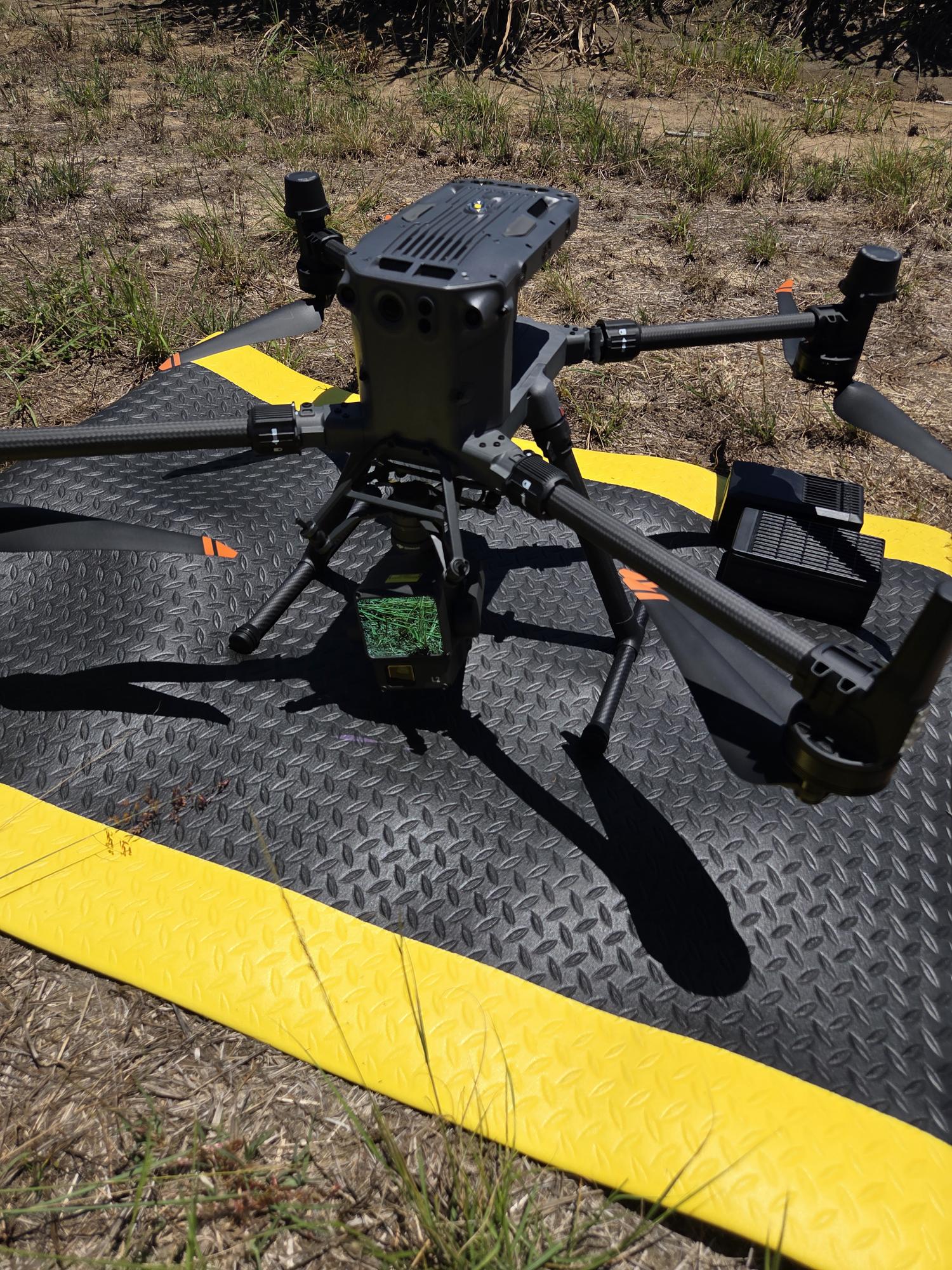
Figure 1. LiDAR drone utilised to capture site data

However, nature had other plans. Following significant flooding associated with Ex-Tropical Cyclone Koji in January 2026, three of the five project sites experienced substantial additional erosion. In some locations, creek banks retreated by up to eight metres, requiring engineers to revisit and redesign the restoration works before approvals could proceed. 
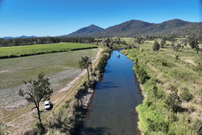
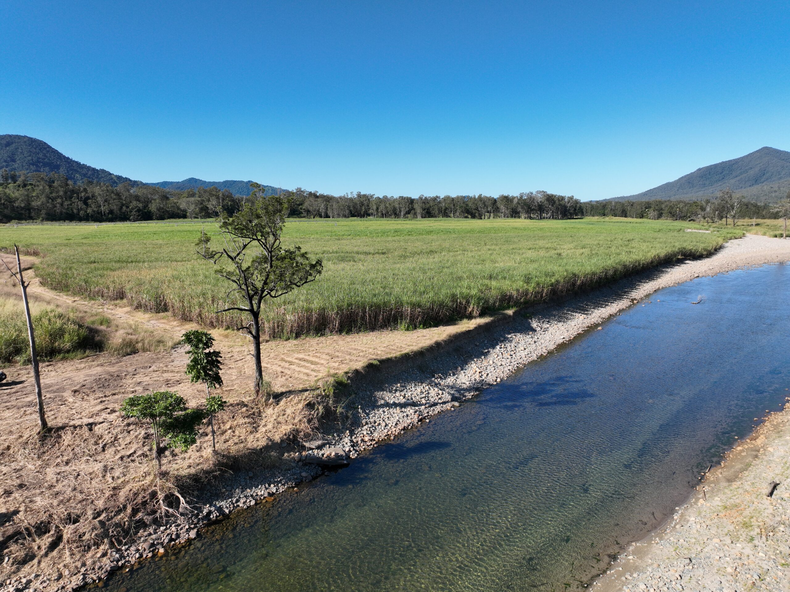
Figure 2. Restoration site before ex-Tropical Cyclone Koji, in July 2025
Figure 3. Restoration site after ex-Tropical Cyclone Koji, in January 2026

The Logistics Behind Restoration 

 Behind the physical works, months of logistical planning quietly shape whether a project like this can succeed. 

To prepare for construction and revegetation activities, Reef Catchments staff coordinated suppliers, contractors, landholders and regulatory requirements months in advance. 

Additionally, the sourcing of materials was required to have months of led out time. The project requires approximately 10,000 native plants to be propagated from locally sourced seed stock. Orders were placed in December 2025 to allow sufficient time for collection, propagation and growth. 
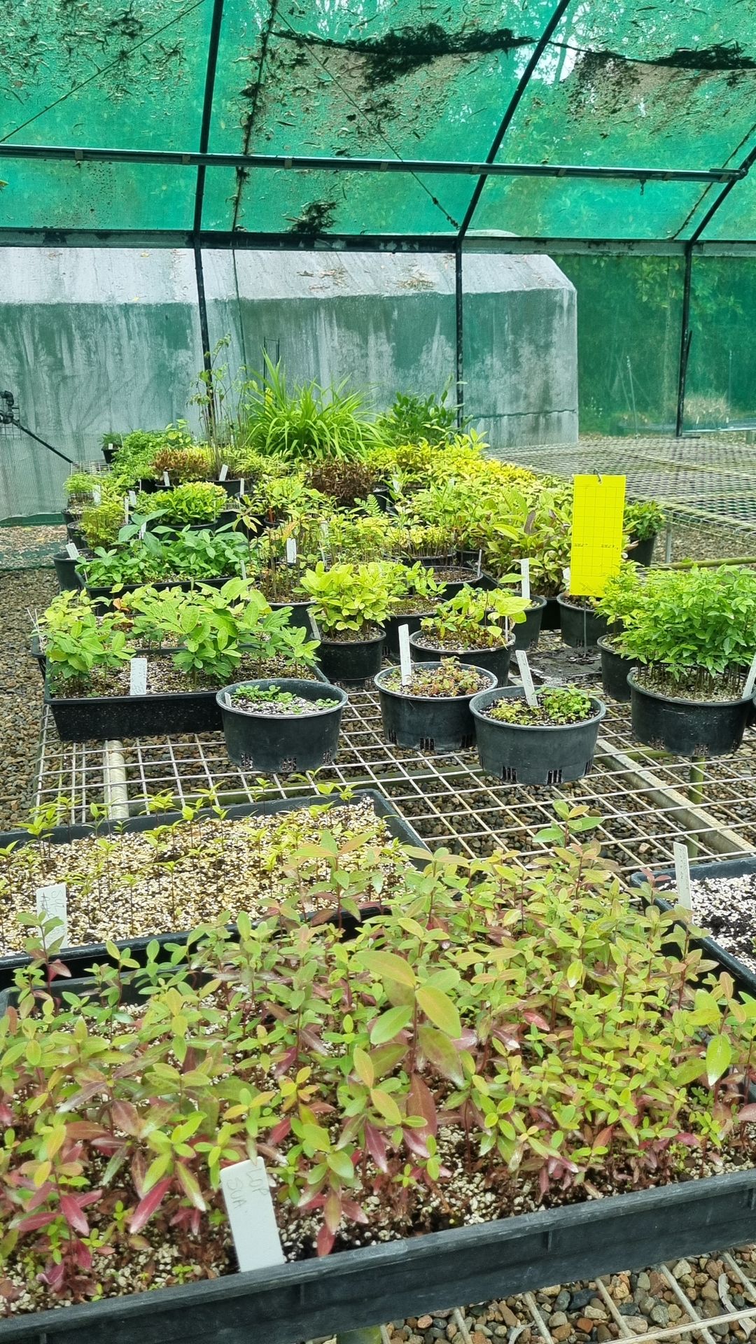
Figure 4. Plants being propagated at Mackay Natural Environment Centre

Construction planning has also involved sourcing more than 12,700 tonnes of armour rock, equivalent to over 500 truckloads of material, to stabilise the actively eroding streambanks. 
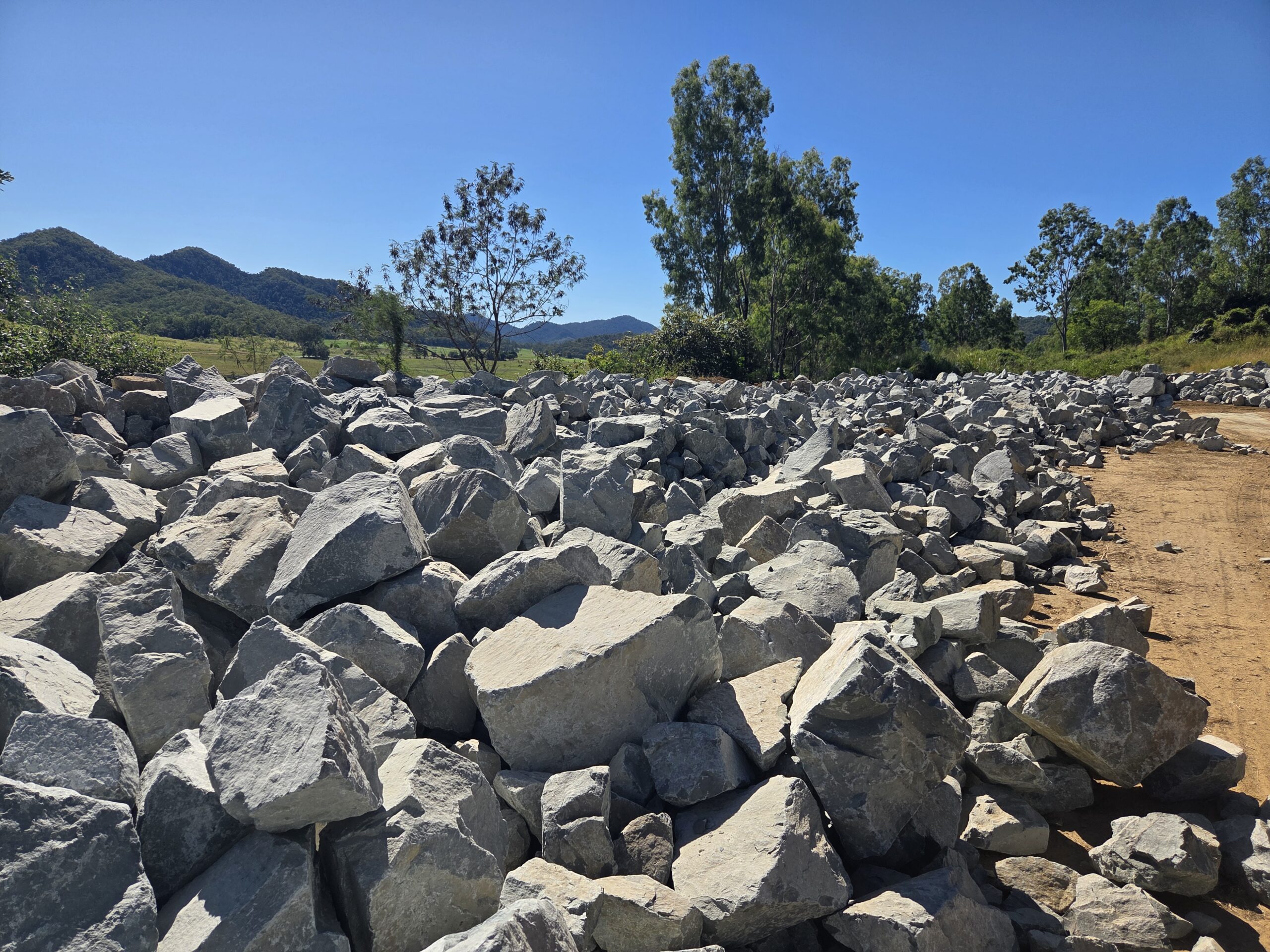
Figure 5. Rock stockpile to be used at restoration sites

Before machinery arrives, sites must be prepared – vegetation slashed for visibility, laydown areas established for rock and root balls, access tracks assessed and upgraded, safety signage installed. This groundwork is unglamorous but it’s what allows construction to run efficiently and safely once conditions are right. 


Building Strong Partnerships 

The project highlights the importance of collaboration between landholders, engineers, environmental specialists, native plant growers, contractors and Reef Catchments staff. 

Each group contributes specialised knowledge that helps transform an identified erosion hotspot into a functioning restoration site capable of protecting productive land, improving water quality and increasing the resilience of the Cattle Creek system. 

The completed restoration works will be what the community sees. But every plant in the ground, every tonne of rock placed, will have been months in the making -planned, sourced and coordinated long before a machine ever reached the bank. 

The Cattle Creek Restoration works have been funded by the Queensland Government’s Natural Resource Management Expansion Program. 
Logo Reef Catchments.

Collaborative workshop strengthens koala conservation planning

jamie · Jun 29, 2026 · Leave a Comment

Traditional Owners, land managers and scientific experts recently came together for a collaborative two-day workshop to guide koala conservation planning across the Mackay Whitsunday Isaac region – improving how investment is targeted, and ensuring the right work happens in the right places under Reef Catchments’ Improving Koala Habitat and Connectivity project. The project is part of the Queensland Government’s $117.84 million Natural Resource Management Expansion Program (NRMEP).

Held at Eimeo Surf Life Saving Club, the workshop included Yuwi Rangers, Pioneer Catchment Landcare, CSIRO scientists and members from the Reef Catchments Biodiversity team, working together to identify priority areas for koala presence surveys. 


Strong partnerships shaping practical outcomes 

The workshop created an open and collaborative environment where participants could share knowledge, discuss landscape challenges and focus on practical opportunities for on-ground action. By bringing together scientific expertise with local land management experience, the group identified priority survey sites that are both ecologically important and achievable to access and manage. 

Reef Catchments Senior Project Officer (Biodiversity) Carlos Bueno said the workshop demonstrated the value of aligning technical knowledge with local delivery experience. 

“This workshop was about making sure we focus our efforts where they will have the greatest impact,” Carlos said. 

“The groups on-ground experience was critical in identifying sites that are not only important for koalas, but also feasible for survey work and future restoration.” 

Participants worked together to assess site suitability, consider access and management requirements, and identify where coordinated effort could deliver the greatest benefit for koala conservation and broader landscape health. 

“Having our local groups involved early means we’re planning with implementation in mind,” Carlos said.

“It helps ensure the work we prioritise is practical, efficient, and set up to deliver long-term results.” 

This collaborative approach helps reduce duplication, improve efficiency, and ensure resources are directed to areas where they will achieve the strongest outcomes. 

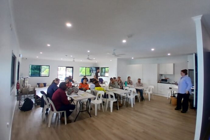
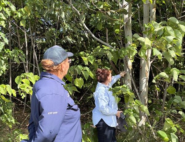
Pictured: Pioneer Catchment Landcare, Yuwi Aboriginal Corporation, CSIRO and Reef Catchments representatives collaborating on koala conservation tactics for the NRMEP Improving Koala Habitat and Connectivity project.  


Building stronger data to drive smarter investment 

Strong, consistent data is critical to the success of the project and was a key focus of the workshop. CSIRO’s Charley Geddes and Dr. Jonh McEvoy led the technical component, introducing participants to koala survey design and monitoring methods under the National Koala Monitoring Program (NKMP). 

“By working with local partners and providing training in consistent survey methods and tools, we’re improving how we measure change over time and contributing to a broader understanding of koala habitat across the state,” said Charley.

Sessions focused on how to identify koalas in the field, including daytime searches and night spotlighting, and how to apply consistent, science-based approaches to data collection. Aligning local efforts with these national standards ensures the data collected is reliable, comparable and usable beyond the region – strengthening its value for decision-making and long-term conservation planning. 

Participants were then introduced to digital tools that support this approach, including the Koala Counter app for structured surveys and Koala Spotter, which enables both practitioners and the community to record observations. They were also walked through the Koala Condition Assessment tool – known as “KoalaCAT.” 

“The nearly developed KoalaCAT will play a key role in measuring the project’s long-term impact since good data underpins good decision-making,” Carlos said.

“This methodology captures practical indicators that measure short term improvements in koala habitat, indicators such koala food and habitat tree recruitment, weed impacts on their food trees, as well as data on koala predator activity. By using consistent methods and tools, we can track change over time and clearly demonstrate the outcomes of our investment.”

Importantly, this ensures that data collected on-ground feeds into regional and statewide reporting, aligning with NRM Regions Queensland (NRMRQ) indicator frameworks. This enables Reef Catchments to demonstrate measurable outcomes, linking on-ground works directly to improvements in habitat condition and koala conservation, while guiding future investment. 

The workshop also included practical field activities, giving participants the opportunity to trial survey techniques and data collection in real-world conditions. Follow-up field training scheduled for later in the year will further build local capacity to carry out surveys and contribute to ongoing monitoring. 


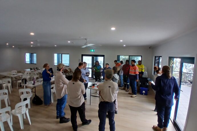
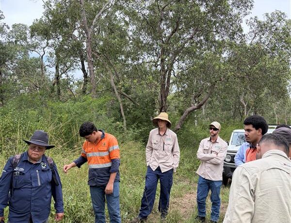
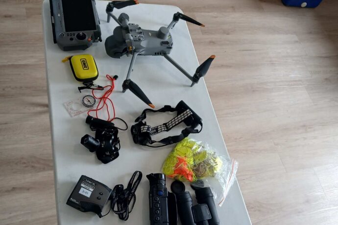
Pictured: Participants in the field learning to conduct a Koala transect to identify Koala presence and main fodder species (left and center), range of equipment to be used in monitoring and data collection for the NRMEP Improving Koala Habitat and Connectivity project (right).
 

Supporting the future of koalas in our region 

Beyond site selection, the workshop strengthened relationships between project partners and built a strong foundation for coordinated delivery. Carlos said ongoing collaboration between organisations will be key to achieving meaningful results. 

“We’re bringing together the right mix of skills, from scientific expertise through to local knowledge and on-ground delivery,” he said.

“That combination is what allows us to plan effectively and follow through with action that makes a real difference.”

The immediate outcome of the workshop is a refined set of priority survey sites, informed by technical data and local experience. Over time, this work will guide where habitat is protected and restored, improve understanding of koala population, and ensure investment is directed to areas where it will deliver the greatest impact. 

For a region where koala populations are under increasing pressure, this work is vital. Reef Catchments NRM is ensuring conservation efforts are coordinated, targeted and measurable, supporting the long-term future of this iconic species. 


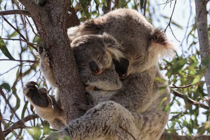
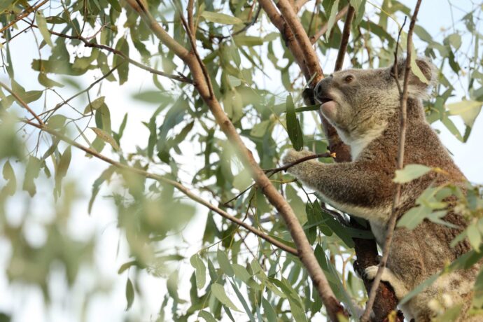
Pictured: Local Koalas captured by CSIRO’s Dr Charley Geddes 


Reef Catchments logo.


This project is funded by the Queensland Government through funding from the Natural Resource Management Expansion Program (NRMEP). 

Cattle Creek begins long‑awaited restoration works

jamie · Jun 24, 2026 · Leave a Comment

Cattle Creek moves quickly. Rising in the Clarke Range, it flows east through Finch Hatton into the Pioneer River, one of the region’s most flood‑prone systems. The Bureau of Meteorology notes frequent flash flooding; when rain falls, water levels rise fast and the creek actively cuts into its banks. 

For years, that has reshaped the landscape. Repeated flooding has driven ongoing erosion, with productive paddocks gradually lost as banks fail season after season. Landholders consistently raised the impacts – land loss, instability and declining water quality – but the scale of response needed sat beyond available funding. 

This project reflects a shift from issue to action. 

Local knowledge defined the problem. Reef Catchments built the evidence to target priority sites, and NRM Regions Queensland (NRMRQ) helped secure the Queensland Government’s $117.84 million investment into regional Queensland landscapes through the Natural Resource Management Expansion Program (NRMEP). 

Of that investment, more than $4.8 million is now being delivered on the ground at Cattle Creek.  

Five sites across two kilometres of streambank will be stabilised, reducing active erosion, improving water quality and strengthening the resilience of surrounding land. It is the first coordinated riverbank restoration effort in this system in over 20 years. With work now underway, it provides long‑sought support for local landholders.  

A system on the brink 

The sheer force of Cattle Creek was evident during Severe Tropical Cyclone Debbie in 2017. The Clarke Range received nearly 1 metre of rain in 48 hours, pushing Cattle Creek, Blacks Creek and the Pioneer River into major flood. Reef Catchments later found a clear pattern across the region: where riverbank vegetation was intact, banks held. Where it had been cleared or degraded, as along much of Cattle Creek, erosion was severe and recovery costs were much higher. While Debbie caused $3.5 billion in damage overall, for local landholders the loss was in productive farmland. 

In 2018, fire intensified that damage. More than 400 hectares of cane burned in the Pioneer Valley, and flames carried into rainforest. Along Cattle Creek, riparian corridors lost remaining cover and stability, leaving banks exposed and unprotected. 

By the 2019 wet season, the system had little resilience left – more or less functioning as a conduit for erosion. Heavy rainfall hit bare, unstable banks with limited capacity to absorb water. Erosion worsened rapidly, and landholders saw productive land collapse into the creek, asking when support would come. 

In January 2026, Tropical Cyclone Koji brought up to 700mm of rain to already saturated catchments. Floodwaters surged through Finch Hatton and surrounding areas, and at key sites, banks retreated by up to eight metres in a single event – removing land and resetting recovery efforts. 

In just nine years, four major events progressively reduced the system’s capacity to hold together. By 2026, Cattle Creek operated as an unstable, highly reactive system, with erosion driving ongoing loss for landholders. 

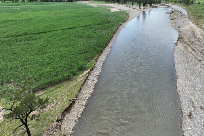
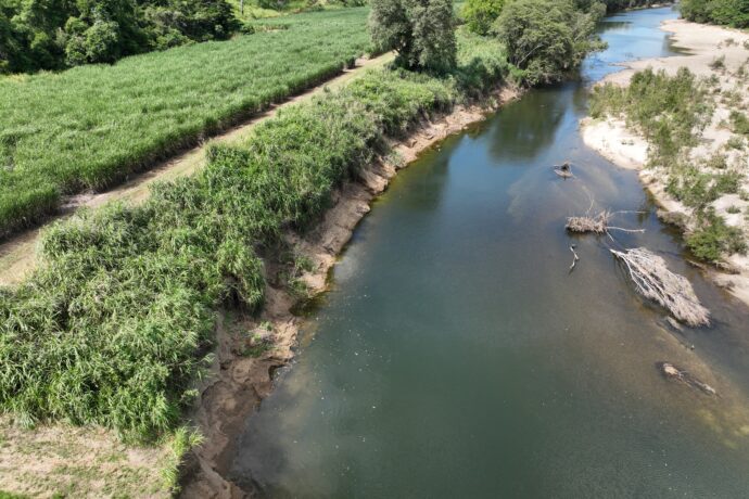
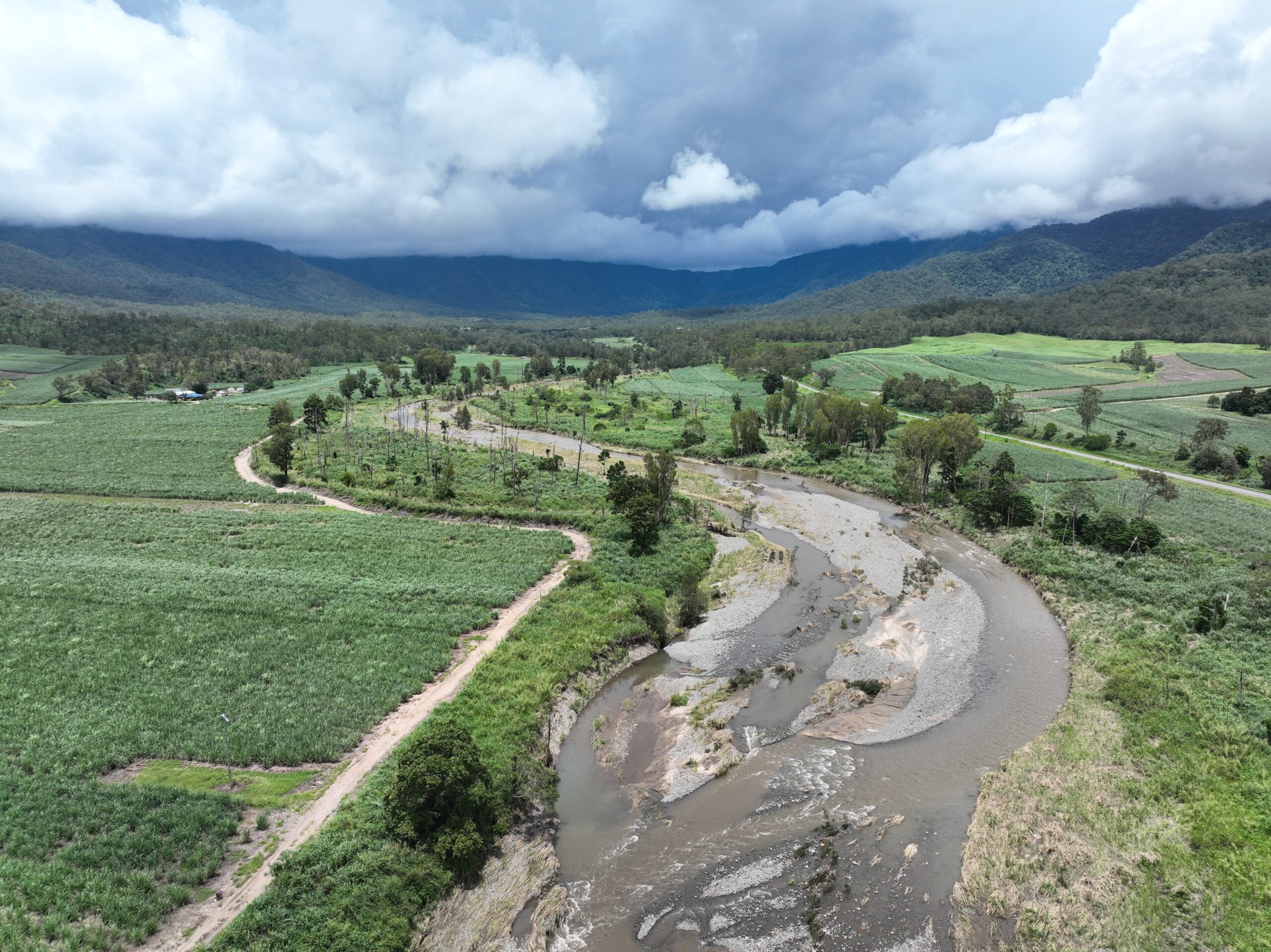
Figure 1 – Example of erosion evident in Cattle Creek 01 June 2026

Multiple voices, one call to action 

For years, landholders along Cattle Creek raised the same issue. Through repeated flood events, they have watched banks fail and productive land steadily lost. They understand where flooding occurs, which sections give way and how the system changes over time. This experience shaped the case for action. 

Delivering restoration required coordination across community, regional organisations and government. Landholders identified the impacts, Reef Catchments built the evidence, and NRM Regions Queensland worked with regional organisations to secure a program the Queensland Government could fund. Together, this moved a long-identified priority into delivery. 

“Cattle Creek is part of the livelihood and family history for many people in the region, and there is a deep concern for maintaining the health of the creek,” said Emma Jones, Principal Project Officer at Reef Catchments.

The project is now being delivered on private agricultural land, with landholders supporting access, guiding works and contributing to long term outcomes. 

Glen Kelly MP, Member for Mirani, represents Finch Hatton, Cattle Creek, Eungella and the Pioneer Valley. As a sixth-generation farmer from Kalapa, he brings an understanding of how creek condition affects farms and communities. 

When the NRMEP funding for Cattle Creek was announced in November 2025, Glen described it in terms that went to the heart of why the project matters to people in the region rather than just to its environmental metrics.  

“From protecting koala habitat to restoring critical waterways, this is the Crisafulli Government backing local solutions and restoring trust in regional investment. Healthy ecosystems mean stronger farming, more resilient communities and better outcomes for future generations,” said Glen Kelly MP.

Enabling investment at scale 

NRMRQ, the peak body for the state’s 12 regional Natural Resource Management (NRM) organisations, worked with organisations including Reef Catchments to build the case for expanded investment in Queensland, shaping the NRMEP – structured around the regional organisations already trusted by landholders, councils and communities.  

Minister for Natural Resources, Dale Last, was direct about the logic: back the people who know their regions, give them the tools, and get results on the ground. 

“This investment is about backing local NRM organisations who know their regions best and giving them the tools to get results on the ground,” said Minister Last.

This approach connects local knowledge, technical evidence and government funding, enabling regionally led delivery of projects like Cattle Creek. NRMRQ’s role has been to build and sustain the policy and funding framework that supports this work, with regional organisations delivering outcomes on the ground and government investing in proven capability. 


A pathway to progress 

Reef Catchments has been working in the Pioneer catchment for decades, and the foundation for the Cattle Creek project was build though sustained technical work. 

Following Cyclone Debbie, Reef Catchments partnered with Neilly Group Engineering to deliver a regional erosion identification, prioritisation and remediation study across the Mackay Whitsunday Isaac region. This work mapped where intervention would deliver the greatest benefit and identified Cattle Creek as a high priority site. 

At the same time, Reef Catchments was demonstrating what targeted Natural Resource Management (NRM) investment in this region could achieve. Through Reef Trust programs, Reef Catchments partnered with hundreds of agricultural properties to reduce streambank erosion, lower sediment losses to the Great Barrier Reef, and plant over 100,000 trees to strengthen riparian zones.  

The Cattle Creek project builds on that foundation, with established partnerships, proven approaches and technical expertise supporting delivery. 

Before works
After works

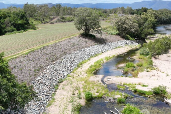
Figure 2 – Before (28/02/2025) and after (19/12/2025) images of similar streambank remediation works funded by the Australian Governement’s Landscape Repair Program in the O’Connell River. 


The work on the ground  

The Cattle Creek project targets five priority sites across two kilometres of creek. Works include rock armouring to stabelise the most active erosion areas, installation of in-stream woody habitat to slow water velocity and provide refuge for aquatic species including local platypus populations, and planting 10,000 locally sourced native plants grown at Mackay Natural Environment Centre. Construction is being delivered by local contractors, keeping investment within the regional economy. 

These works focus on the highest‑risk sections, but erosion extends well beyond the project footprint. Broader catchment data identifies a much larger area of concern, and sediment movement from Cattle Creek into the Pioneer River and Great Barrier Reef lagoon will not be resolved by this project alone. 

What this investment provides is a working model at scale. It demonstrates that targeted, reach‑level restoration can stabilise banks, that landholders will partner in delivery, and that measurable outcomes can be achieved. This evidence is critical to informing future investment across the catchment. 

Figure 3 – Demonstration of why Cattle Creek requires reach scale investment, the system has limited resilience and protection.


Cattle Creek has been a long identified priority. Construction is now underway, shifting the system from sustained impact to active restoration and delivering tangible progress on an issue the community has raised for years. The Cattle Creek project demonstrates the value of local knowledge, strong partnerships and targeted investment in restoring resilient working landscapes. 

Logo Reef Catchments.

Transforming Citizen Science into On-Ground Action 

jamie · Jun 19, 2026 · Leave a Comment

Mangroves and saltmarshes are amongst the most valuable – and vulnerable – blue carbon ecosystems along the Mackay coastline. They stabilise shorelines, filter water flowing to the Great Barrier Reef, store carbon and provide habitat for fish and wildlife. When they decline, the impacts are felt across the entire coastal system. 

Reef Catchments’ Inshore Resilience project is working to reverse that trend by turning years of community-collected data into targeted, measurable on-ground restoration. Delivered through the Queensland Government’s $117.84 million Natural Resource Management Expansion Program, the project establishes a formal partnership with Eathwatch to ensure restoration is guided by robust, locally collected evidence.  

At its core, the project answers a simple question: what happens when citizen science doesn’t stop at monitoring, but directly drives action? 

mangrove at low tide with root system exposed.

From community insight to on-ground works 

For nearly 20 years, MangroveWatch has supported communities across Australia to monitor mangrove and saltmarsh ecosystems. In the Mackay region, that work has created a strong evidence base, with data collected by Traditional Owners, Pioneer Catchment Landcare, Reef Catchments and community volunteers through the Earthwatch Australia–MangroveWatch partnership, with support from Great Barrier Reef Foundation. 

In 2025, that data was brought back to the community through Local Action Planning workshops. The data represented 112.8 km of shoreline mangrove monitoring across three estuaries, along with surveys of 12 saltmarsh sites comprising more than 200 individual assessments. This work was delivered by 100 community members contributing over 700 hours of citizen science effort.  Through the workshops, participants reviewed what had changed across their local sites, identified key threats and prioritised areas for action. 

Building on this momentum, Mackay Conservation Group has secured separate funding to continue saltmarsh monitoring efforts, building on the strong foundation established through MangroveWatch. This ongoing data collection will help track how these ecosystems respond over time and inform future on-ground priorities. 

“Over many years, MangroveWatch has worked with Traditional Owners, community volunteers and local organisations to build a better understanding of Mackay’s coastal wetlands and track their health over time through citizen science,” said Jock Mackenzie, Co-Founder MangroveWatch & Senior Program Manager at Earthwatch Australia. 

“What’s exciting about this project is seeing those observations and local knowledge translated into real on-ground action to protect Mackay’s coastal wetlands. That’s how citizen science moves beyond monitoring to create lasting stewardship, helping communities play an active role in identifying priorities and shaping the future of the places they care about.” 

Reef Catchments identified an opportunity to take the next step; moving from knowledge to implementation. Using MangroveWatch data and community priorities, two sites were selected for immediate action: 

  • a mangrove system along the Pioneer River 
  • a saltmarsh wetland at Bucasia 

Six months into the project, on-ground works are now underway, including weed control, revegetation and access management to reduce pressures such as illegal vehicle use. These actions are targeted responses to site-specific threats identified through citizen science data. 

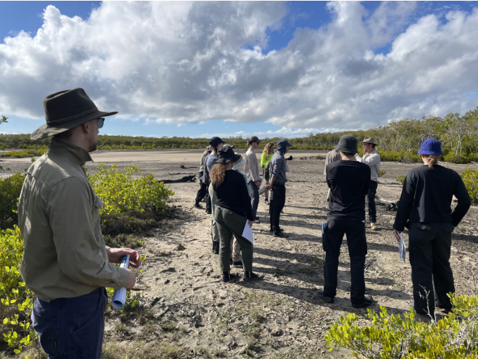
MangroveWatch training at the Bucasia saltmarsh 
MangroveWatch training at the Bucasia saltmarsh.

Measuring ecosystem recovery 

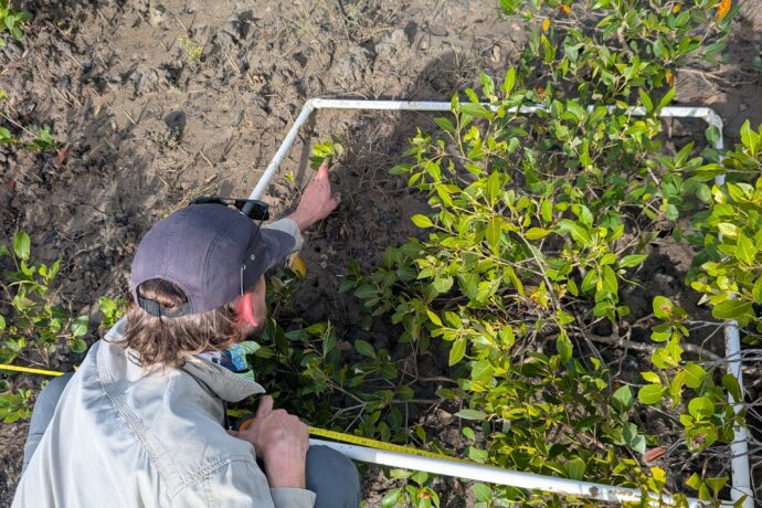
A defining feature of the Inshore Resilience project is its focus on measurable outcomes. Before works began, Reef Catchments – alongside the Yuwi Aboriginal Rangers and MangroveWatch – established baseline condition data for both sites. This included vegetation structure, weed presence, and key ecological indicators. By establishing this baseline, the project creates a clear framework to track change over time. 

Great Barrier Reef team Senior Project Officer Morgan Thomas said this approach is critical to demonstrating real impact. 

“We’re not just implementing restoration; we’re setting up a system to demonstrate that what we are doing is working and helping to build resilience at these sites” Morgan said. 

“We’ve established baselines for vegetation, site condition, and indicators such as crab burrow density, so we can track improvements over time. That gives us a clear line between the actions we take and the outcomes we achieve.” 

“It also means the community can see the difference their data has made – from identifying the problem, right through to measuring recovery.” 

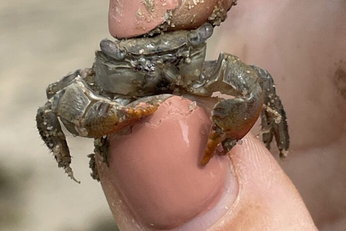
During baseline surveys, the team found an Australasian mangrove crab, suspected to be Parasesarma longicristatum. If confirmed, this would be the first recorded sighting in the Mackay region; a significant finding that expands understanding of local biodiversity and habitat range. 

“One of the most telling indicators of saltmarsh recovery is crab activity, as burrows reflect improving sediment conditions and return of ecological function” Morgan said. 

“The potential presence of Parasesarma longicristatum is particularly exciting because there are no documented records for this species in the region. Discoveries like this highlight how restoration work is not only improving habitat condition but also deepening our understanding of the ecosystem itself.” 

“Establishing baseline data on crab activity ahead of restoration works will provide us with one of many ways for tracking ecological change over time and understanding how the wetland responds following intervention.” 

Small grab in between fingers
Parasesarma longicristatum
Reef Catchments SPO Morgan Thomas conducting saltmarsh ecotone assessments

Delivering measurable impact 

The Inshore Resilience project demonstrates a model for impact-driven restoration: 

  • Data-driven site selection – using long-term citizen science to prioritise where investment will have the greatest benefit 
  • Baseline establishment and ongoing monitoring – enabling before-and-after comparisons of ecosystem condition 
  • Targeted interventions – addressing specific, identified threats at each site 

The Inshore Resilience project underscores the value of local knowledge, strong partnerships and on-ground action in building resilient landscapes for Queensland’s future. 

Reef Catchments logo.

Strengthening Restoration Outcomes to create Healthy Country and Healthy People

jamie · Jun 12, 2026 · Leave a Comment

When we think about revegetation success, it is easy to picture rows of young plants stretching across a landscape. The scale can be impressive, but the real story unfolds over time, in what takes hold, what grows strong, and how Country responds. That is the true measure of success. 

On Country, those changes are always being read. Subtle shifts in vegetation, the way the canopy fills in, the presence of preferred species, and the spread of weeds all speak to the health of the land. For Traditional Owners, this way of observing and understanding Country has guided care for tens of thousands of years. 

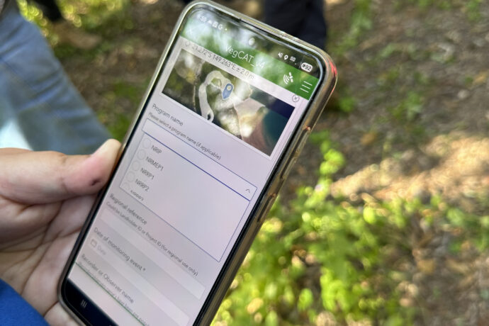
VegCAT, the Vegetation Condition Assessment Tool developed by NRM Regions Queensland, builds on that way of seeing. It provides a practical, consistent way to record observations and assess changes in vegetation condition over time. It is a rapid field tool designed to track how sites are responding to management actions, helping demonstrate whether interventions are supporting a trajectory toward healthier vegetation. 

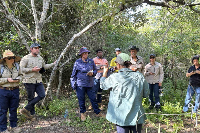
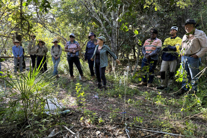
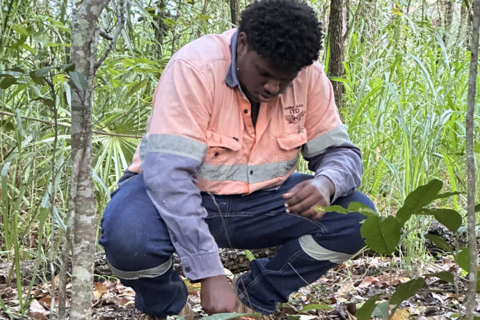
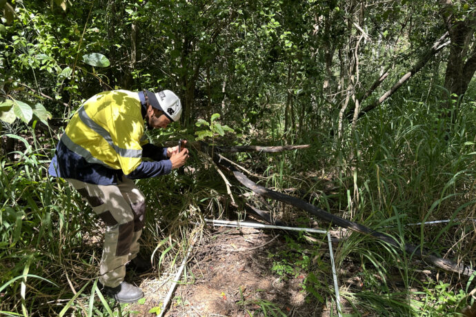
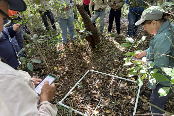
Through the Queensland Government’s Natural Resources Recovery Program, Reef Catchments is delivering the Regional Coordination and Evaluation (RCE) project to strengthen the skills of delivery partners across the region. As part of this work, recent VegCAT training brought together Reef Catchments, NRM Regions Queensland, Farmacist, Pioneer Catchment & Landcare, Sarina Landcare, and Traditional Owner groups Yuwi Rangers and Koinmerburra Aboriginal Corporation. Together on Country, participants walked sites, shared knowledge, and built confidence in applying VegCAT to monitor and improve restoration outcomes. 

“Country is always speaking. Tools like VegCAT help capture those changes in a way that bridges Traditional Owner knowledge with long-term monitoring,” said Jamay Deshong, Reef Catchments Biodiversity Project Officer and Koinjmal Traditional Owner. 

Building Capability on Country 

The training focused on building practical skills that partners can apply directly in the field. Participants assessed vegetation structure and size classes, canopy condition and weed load to understand how sites are responding to restoration efforts. 

VegCAT does not aim to capture every detail of biodiversity. Instead, it focuses on key indicators that are sensitive to change over the life of a project. This allows practitioners to consistently track progress, identify where interventions are working, and spot areas that need additional attention. 

For Traditional Owner groups, this strengthens existing knowledge by providing a consistent way to record and communicate what is being observed on Country. It supports day-to-day decision-making and long-term planning, while building capability to deliver monitoring as part of funded programs. 

Feedback from attendees highlighted the practical and engaging nature of the training, with participants valuing the hands-on, on-Country learning approach, opportunities to build new skills, and time to connect with others in the field. Many reported increased confidence in using the VegCAT tool following the workshop, alongside strong satisfaction with the overall content and delivery. Participants also emphasised the importance of ongoing and future training opportunities, particularly for species-specific monitoring such as koala habitat assessments. 

“It was important for the rangers to learn different ways to do vegetation surveys,” said Marissa Deshong, Chairperson and Lead Ranger for the Koinmerburra Aboriginal Corporation. 

“They have learnt to do bio condition reports using Avenza mapping and field forms, as well as Fulcrum. This training showed them an easier way to do assessments and how the data is used. The training was informative and they have more confidence in their ability to track changes on country.” 

Importantly, this capability extends beyond a single project. Training like this creates pathways for Traditional Owner groups to participate in future programs, including initiatives such as the Queensland Government’s Natural Resources Management Expansion Program (NRMEP) and species-focused projects like koala habitat monitoring, where consistent data collection is essential. 

Why It Matters 

The value of VegCAT lies in what it enables. Consistent data helps partners understand which restoration approaches are delivering results, where effort should be focused, and how management can be improved over time. It supports evidence-based decisions, strengthens reporting, and builds confidence that investment is translating into measurable outcomes. 

For Traditional Owners, this strengthens care for Country by pairing deep cultural knowledge with clear, trackable evidence of change. It supports stronger planning, clearer communication, and greater participation in delivering on-ground projects. 

For delivery partners across the region, it builds a shared and practical skillset. That consistency improves collaboration, supports more targeted action, and ensures restoration efforts are guided by the same understanding of what good looks like. 

Healthy vegetation supports clean water flowing to the reef, provides habitat for native wildlife, and strengthens land for communities. By building capability and using consistent data, the RCE project ensures that these outcomes can be measured, understood and strengthened over time. 

At its core, this work is about listening to Country, understanding what is changing, and turning that knowledge into shared action for the region. 

This training was funded by Queensland Government’s Natural Resources Recovery Program.
Logo for Reef Catchments.


Resilient Catchments Register

Share your knowledge. Register your idea. Shape the future of our land, sea and waterways.

Register now

Get to know us better

You’ll receive our monthly newsletter containing updates on events and workshops, community activities and information about how our projects are helping our regional environment and communities.

  • This field is for validation purposes and should be left unchanged.

© 2026 Reef Catchments · All rights reserved · Site by the dma

  • Disclaimer
  • Privacy Policy
  • Sitemap
  • Contact
  • Disclaimer
  • Privacy Policy
  • Sitemap
  • Contact
Reef Catchments would like to acknowledge the Traditional Owners, past and present, on whose land, sea and waters we work. We acknowledge their enduring spiritual and cultural connection and their responsibility as First People to maintain and care for Country.
While every effort is made to maintain a culturally respectful resource; Aboriginal and Torres Strait Islander people are advised that this website may contain images, voices and names of people who have passed away.