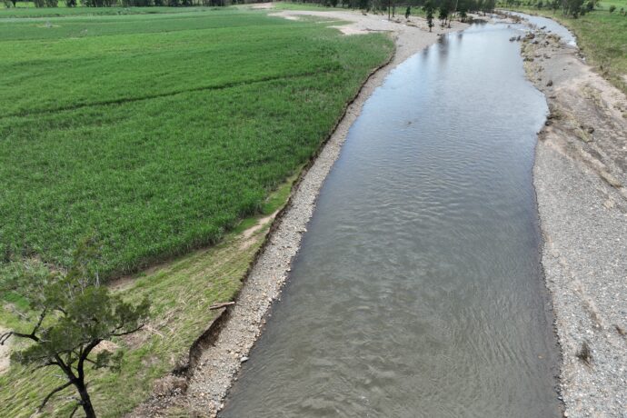
When people visit a completed streambank restoration site, they see the end result – stabilised creek banks, newly established native vegetation, and a healthier waterway. What they don’t see is the months, and sometimes years, of planning that occur behind the scenes before construction can begin.
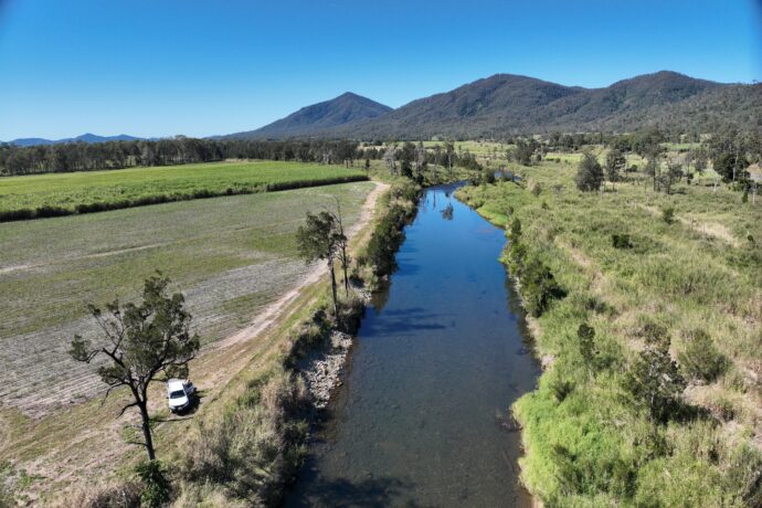
The Cattle Creek Reach Scale Restoration Project is delivering five engineered streambank restoration sites along Cattle Creek, helping reduce erosion, improve water quality, and restore the health of this important waterway. Funded through the Queensland Government’s Natural Resource Management Expansion Program, the project demonstrates that successful restoration starts long before machinery arrives on site.
Identifying the Problem
The journey began in 2023 when several sections of Cattle Creek were identified as priority erosion hotspots through the Mackay Whitsunday regional erosion identification, prioritisation and remediation study. Local landholders also raised concerns about ongoing bank erosion and the loss of productive agricultural land.
Working together, Reef Catchments staff, engineers and landholders inspected the sites to understand the scale of the problem and explore potential restoration options.
“Landholders often see the impacts of erosion firsthand after every wet season. Their local knowledge plays a critical role in helping us identify and prioritise sites that need attention,” said Principal Project Officer Emma Jones.
Turning Ideas into Action
When funding became available through the Natural Resource Management Expansion Program in 2025, years of site information and planning could finally be put into action.
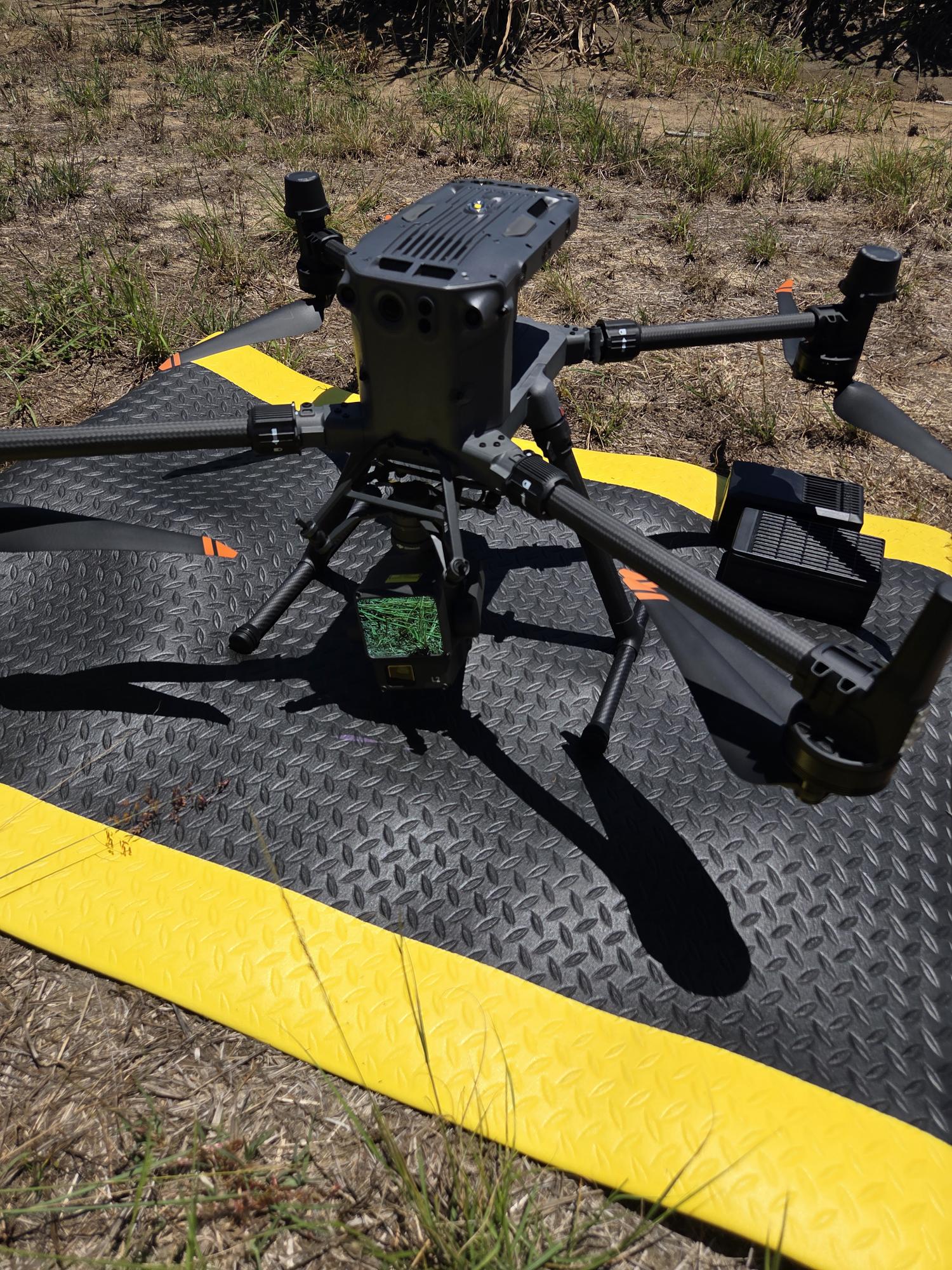
Detailed assessments were undertaken, including site surveys, LiDAR mapping, engineering investigations and ecological assessments. This information allowed engineers to develop restoration designs in late 2025, tailored to each site’s unique conditions. This information was ensured the sites were designed accurately and that impacts to natural assets were minimised.
However, nature had other plans. Following significant flooding associated with Ex-Tropical Cyclone Koji in January 2026, three of the five project sites experienced substantial additional erosion. In some locations, creek banks retreated by up to eight metres, requiring engineers to revisit and redesign the restoration works before approvals could proceed.
The Logistics Behind Restoration
Behind the physical works, months of logistical planning quietly shape whether a project like this can succeed.
To prepare for construction and revegetation activities, Reef Catchments staff coordinated suppliers, contractors, landholders and regulatory requirements months in advance.
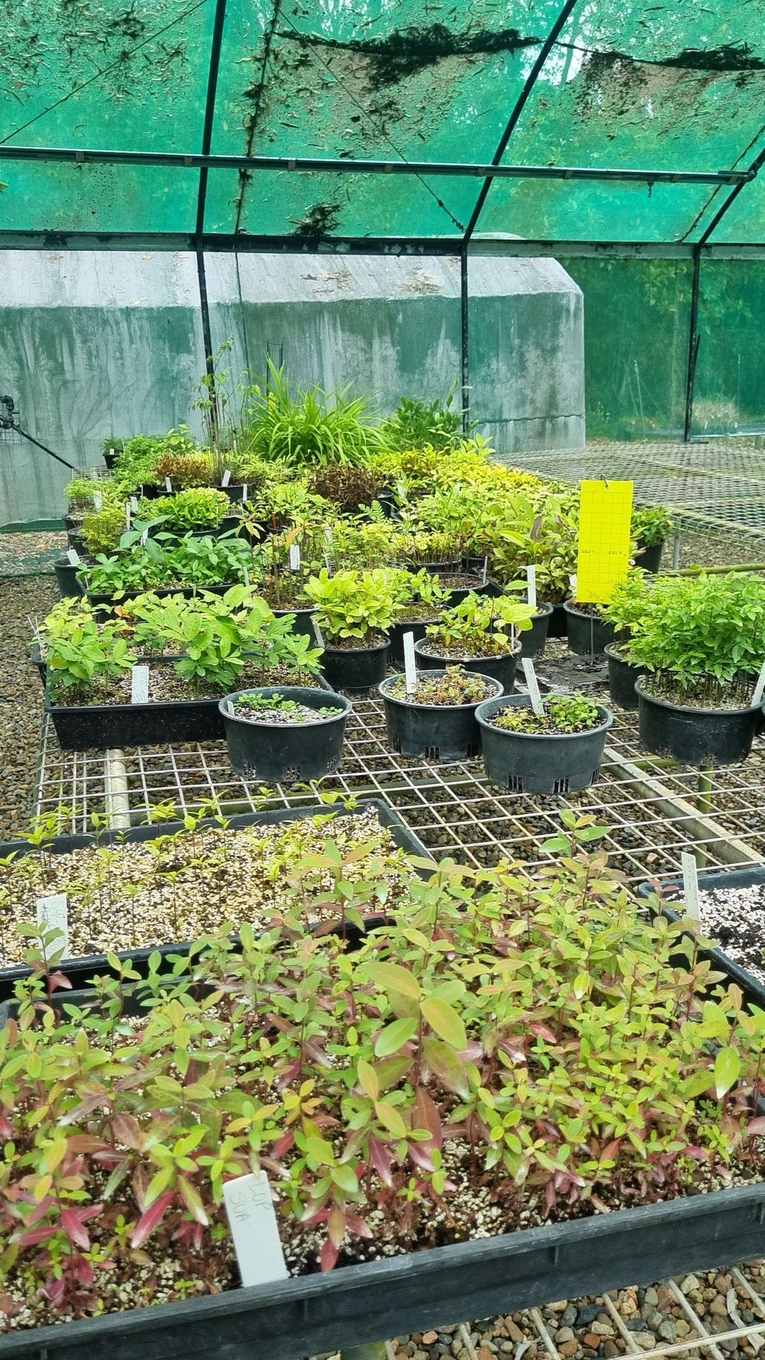
Additionally, the sourcing of materials was required to have months of led out time. The project requires approximately 10,000 native plants to be propagated from locally sourced seed stock. Orders were placed in December 2025 to allow sufficient time for collection, propagation and growth.
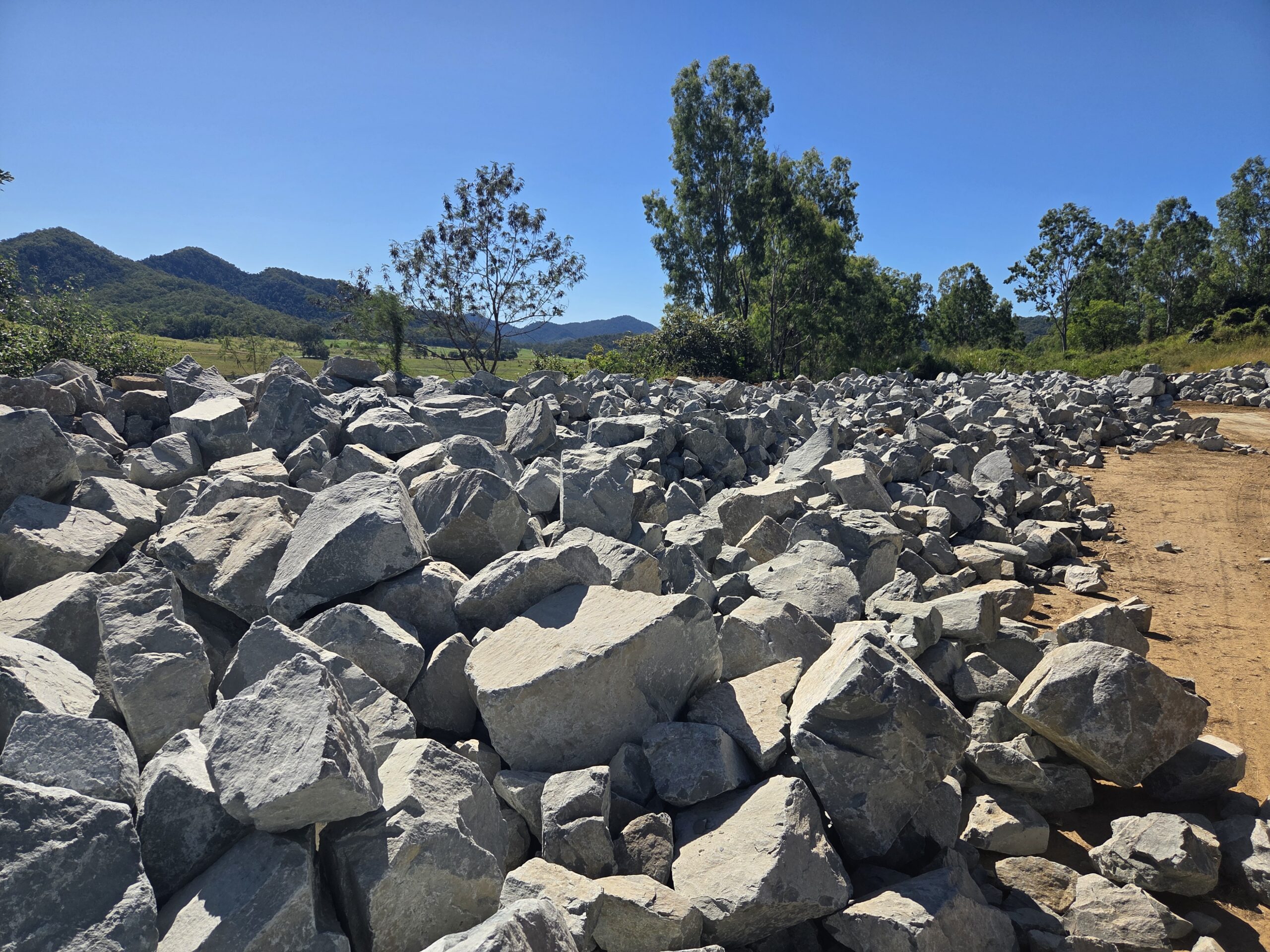
Construction planning has also involved sourcing more than 12,700 tonnes of armour rock, equivalent to over 500 truckloads of material, to stabilise the actively eroding streambanks.
Before machinery arrives, sites must be prepared – vegetation slashed for visibility, laydown areas established for rock and root balls, access tracks assessed and upgraded, safety signage installed. This groundwork is unglamorous but it’s what allows construction to run efficiently and safely once conditions are right.
Building Strong Partnerships
The project highlights the importance of collaboration between landholders, engineers, environmental specialists, native plant growers, contractors and Reef Catchments staff.
Each group contributes specialised knowledge that helps transform an identified erosion hotspot into a functioning restoration site capable of protecting productive land, improving water quality and increasing the resilience of the Cattle Creek system.
The completed restoration works will be what the community sees. But every plant in the ground, every tonne of rock placed, will have been months in the making -planned, sourced and coordinated long before a machine ever reached the bank.
The Cattle Creek Restoration works have been funded by the Queensland Government’s Natural Resource Management Expansion Program.