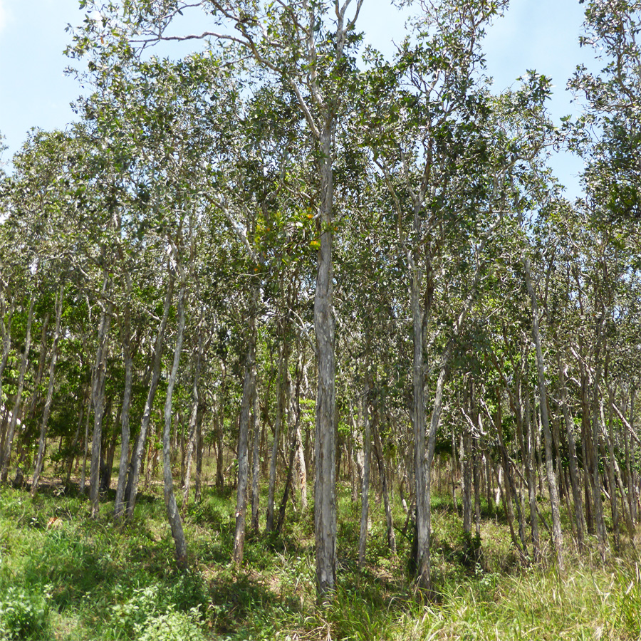
Broad Leaved Tea-Tree Woodlands
Broad Leaf Tea-tree (Melaleuca viridiflora) Woodlands in high rainfall coastal North Queensland
Conservation Status
Queensland State: Endangered
Australian Government: Endangered
Species and status overview
The broad-leaved tea-tree is federally protected under the Environment Protection and Biodiversity Conservation Act 1999 as an endangered ecological community. Activities which may affect the integrity or health of the community may lead to restrictions on: clearing, introducing grazing to un-grazed areas or areas that have not been grazed for some time, improving pastures, applying chemicals for weed control that could affect native species and drainage or land alterations that may affect the natural hydrological regimes.
This vegetation is seasonally inundated for part of the year, with the wet season bringing a number of ephemeral species (only persisting for a short time) to the ground layer, which increases diversity. The broad-leaved tea-tree can mostly be found within 20 km of the coast in high rainfall areas in the Wet Tropics and locally within the Central Queensland Coast bioregion.
They can be found in the following areas
- Greta Creek to the Gregory River
- Phistle Creek to Quandong Creek
- Cape Gloucester
- Lethebrook to the Andromache River
- South west of Marian
- Donriv Creek to Carmilla
Description
The broad-leaved tea-tree can be found as a woodland with a canopy of broad leaved tea-tree (5-14 m). It has a diverse ground layer including grasses, forbs and sedges which characterise this ecosystem, primarily during the wet season. Shrubs are rarely present, however, grass trees (Xanthorrhoea spp.) may be obvious at some sites. This ecological community occurs on poorly drained floodplains with a landform that is sloping to a flat. Just below the surface, a layer of soil occurs that resists water drainage and causes surface water to pool during the wet season.
The nectar of the broad-leaved tea-tree attracts various species including the Rainbow lorikeet, Friarbirds, an array of Honey Eaters and Flying foxes feeding on the flowers. This ecological community also provides habitat for other threatened species such as the Black-Throated Finch and Lesser Swamp Orchid.
The diverse ground layer of this ecological community may contain carnivorous plants such as sundrew (Drosera spp.). Using sweet, stick resin that is highly attractive to insects the sundew ensnares its prey which ultimately die of exhaustion or are suffocated by the mucus. The plant then secretes enzymes that turn the insect into bug-soup that is absorbed through the leaf surface. Sundews can live for up to 50 years.
Early settlers used the leaves of this tree as a substitute for tea and the trunks can be tapped to obtain a slightly salty water.
Conservation concerns
The main threats to this community include clearing for coastal, industrial and agricultural development. Visitor disturbance, fire, weeds and the effect of fragmentation are also contributing conservation concerns. Natural disturbances, such as storms and cyclones can impact this vegetation and with the threat of climate change these events will potentially increase in intensity.
Threats
- Vegetation clearing, grazing and fragmentation
- Myrtle rust
- Hydrological changes
- Weed invasion
What can I do?
- Maintain or enhance existing habitat through revegetation and weed control.
- In grazing country, fencing undeveloped frontage areas to manage grazing during the wet season will reduce erosion and disturbance and allow seeding of native grass species (DPIF, 2007). Spelling outside the wet season will benefit different native species seeding during this time and aid grass diversity and recovery.
- Apply fires of varying extents in various seasons and at fire intervals usually between 5-7 years but allow some areas to remain unburnt longer than 7 years. Aim for a mosaic of around 50%. Fires should be applied from the early to mid dry in most years but occasional storm burns with good soil moisture and where follow up rain is expected may also assist in managing woody weeds (Refer to the Clarke Connors Range Fire Management Guidelines for further information).
Department of Primary Industries and Fisheries (DPIF), 2007. Pastures: Mackay Whitsunday region. A guide for developing productive and sustainable pasture-fed grazing systems. Harry Bishop (ed.), DPIF, Mackay, Queensland.
More Information
Photo credit Kerensa McCallie
