Mapping to Inform Restoration Activities
Part of the Whitsunday Reef Islands Initiative program
Project Lead:University of Queensland, Central Queensland University
Key project partners: Southern Cross University and tourism operators including Ocean Rafting, Red Cat Adventures, SV Whitehaven and Kiana Sail and Dive.
Mapping to Inform Restoration Activities:
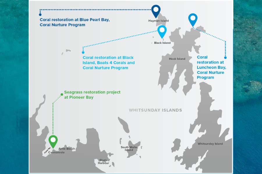
When the Whitsundays was selected as a key Reef Islands Initiative site, one of the first activities was to determine the best locations for coral nurseries and coral restoration to ensure maximum impact of restoration activities. To achieve this, spatial data was mapped throughout the Whitsundays, including habitat distribution, water quality, exposure to stress and local connectivity patterns. Results were presented to local stakeholders for feedback, including tourism operators and Traditional Owners, to ensure that local knowledge and priorities were considered and the chosen sites were suitable. This process was intended to foster site stewardship, a sense of ownership by locals over the program of works at these sites. Final sites selected as a result of this process were: Blue Pearl Bay, Black Island, and Luncheon Bay.
Seagrass mapping was used to select Pioneer Bay as the seagrass restoration site for the Whitsundays. This site has the added benefit of being accessible from the mainland, making it an ideal location for community participation in seagrass restoration activities.


